Hodeidah Governorate Hazard Analysis - Landslides Susceptibility map
|
1 month ago
A-
A+
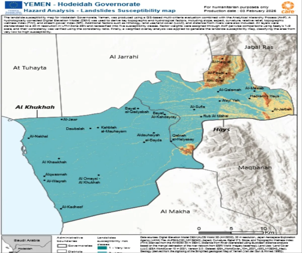
A landslide susceptibility map for Hodeidah Governorate, Yemen, was produced by the humanitarian initiative REACH and its partners , using a GIS-based multi-criteria evaluation combined with the Analytical Hierarchy Process (AHP). A hydrologically corrected Digital Elevation Model (DEM) was used to derive key topographic and hydrological factors, including slope, aspect, curvature, relative relief, topographic wetness index (TWI), and stream power index (SPI). Additional factors such as lithology, land use/land cover (LULC), and distance from rivers were also included. All layers were standardized to a 30 m resolution in UTM Zone 38N and reclassified into five susceptibility classes. Factor weights were assigned through AHP pairwise comparisons using Saaty’s 1–9 scale, and their consistency was verified using the consistency ratio. Finally, a weighted overlay analysis was applied to generate the landslide susceptibility map, classifying the area from very low to high susceptibility. Note: Data, designations and boundaries contained on this map are not warranted to be error-free and do not imply acceptance by REACH partners, associates or donors mentioned on this map |